
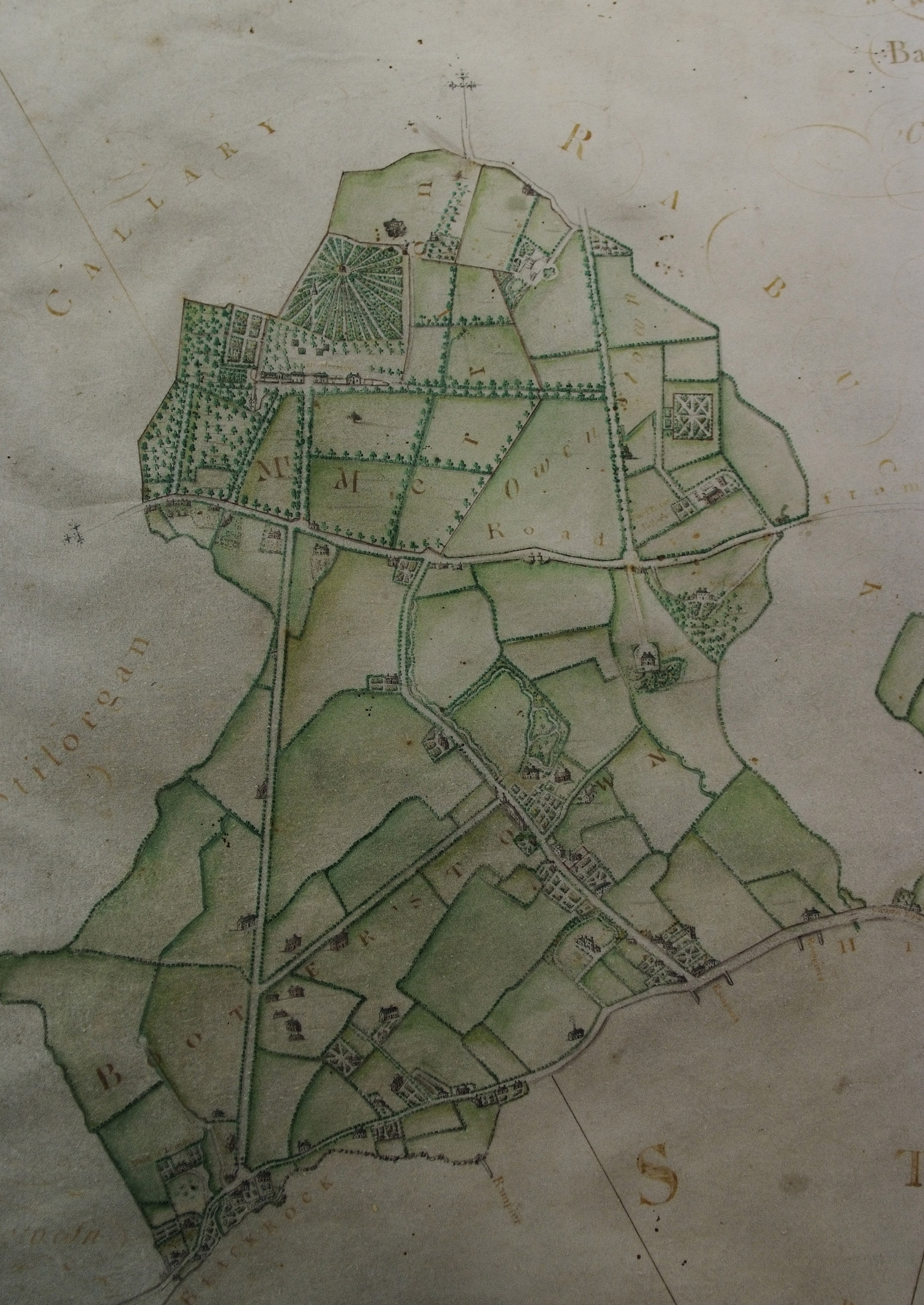
Mount Merrion in 1949 with an overlay of the Barker Map of 1762
|
 |
 |
 |
 |
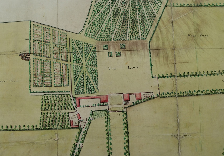
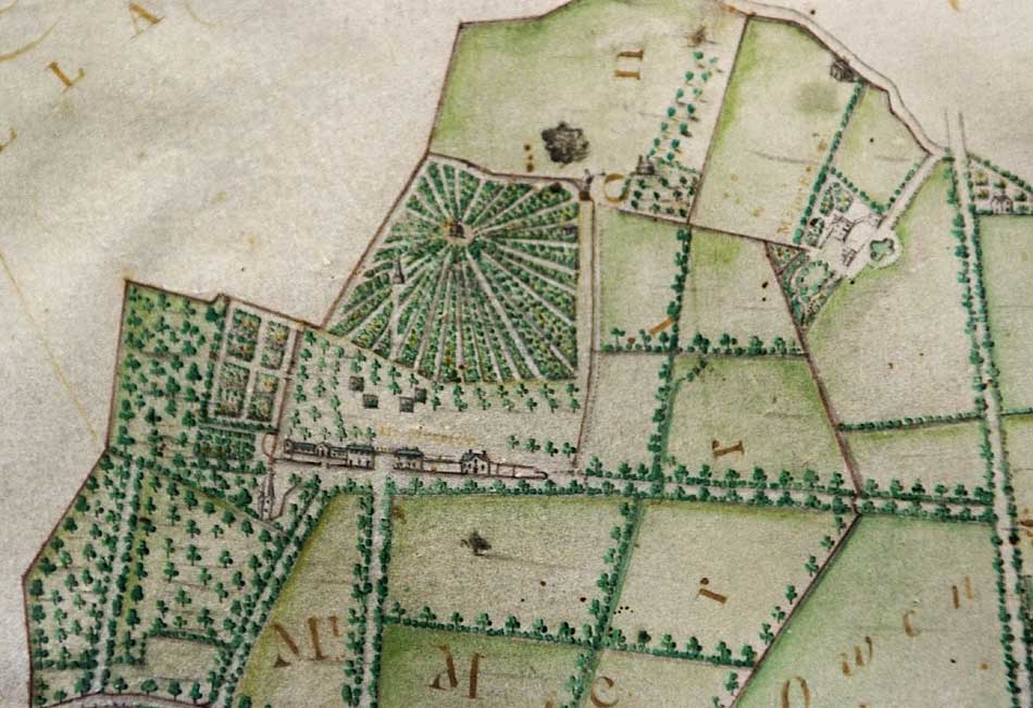
this shows a detail from the map below, executed by cartographer Pat Roe in 1774
|
 |
|
 |
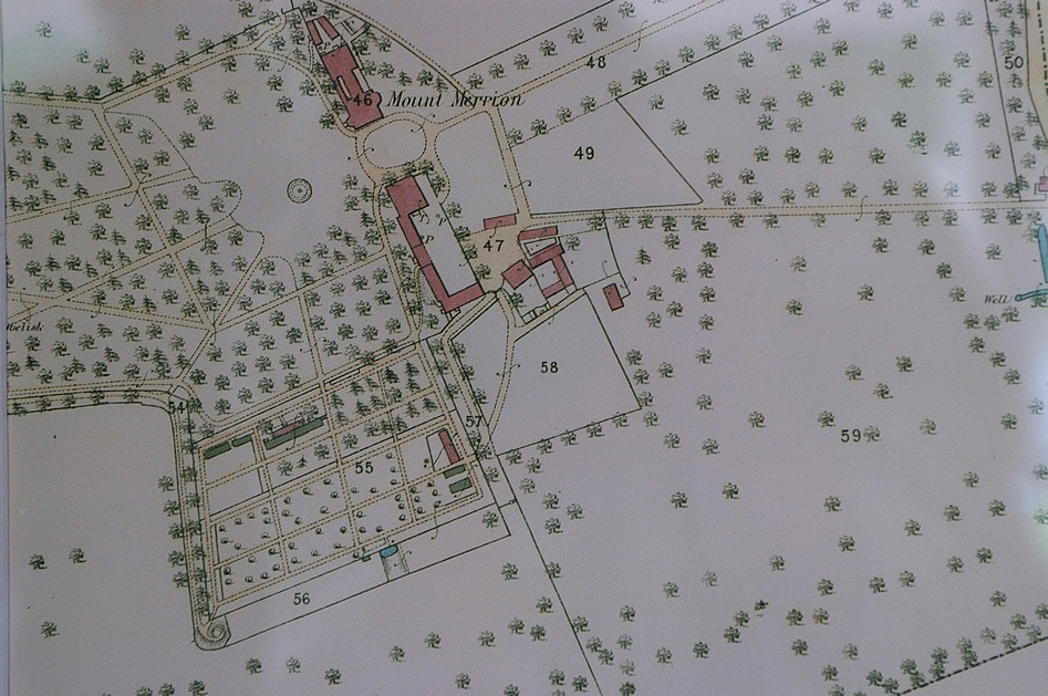
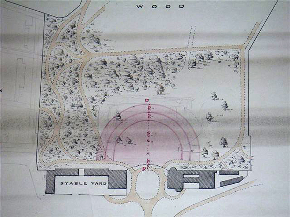
| close up showing the Woods with the 'Shell House' to the top and just below it to the left the 'Obelisk' |
 |